Bauges (67 itin.)
-
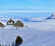
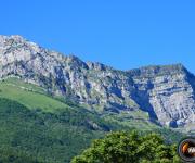
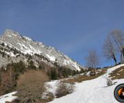
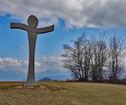
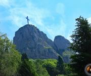
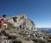
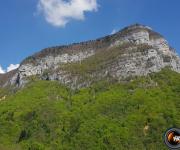
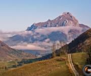
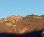
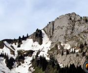
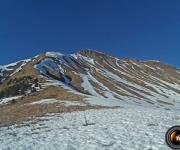
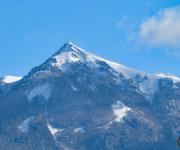
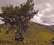
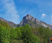
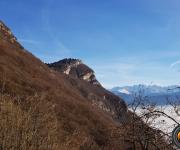
Bauges_ Aulp de Seythenex.
Den: 575 m (M)_ Albertville, Seythenex _iGN 3432 ET. (02/2004) -
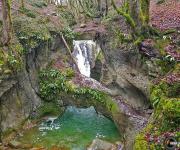
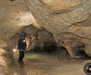
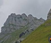
Bauges_ Canyon de Ternezé.
Den: 440 m (M)_ Chambéry, Saint-Jean d'Arvey _iGN 3332 OT. (12/2020) -
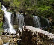
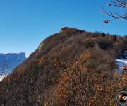
Bauges_ Cascades et trou de la Doriaz.
Den: 500 m (D)_ St Jean d'Arvey, Lovettaz _iGN 3332 OT. (06/2019) -
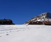
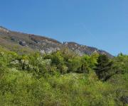
Bauges_ Chalets de la Fullie par Ecole.
Dén: 650 m (F)_ St Pierre d'Albigny, Ecole _iGN 3432 OT. (01/2022) -
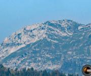
Bauges_ Chapeau de Napoléon.
Den: 800 m (M)_ Col du Frêne, Ecole _iGN 3432 OT. (06/2017) -
Bauges_ Col de Chérel en raquettes.
Den: 520 m(M)_ Ecole, Jarsy, Précherel _iGN 3432 OT. (01/2022) -
Bauges_ Col de la Fullie par Aillon.
Den: 549 m (M)_ Aillon le Jeune, la Correrie _iGN 3432 OT. (02/2018) -
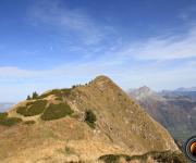
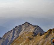
Bauges_ Crêt de l'Aigle.
Den: 1125 m (M)_ Cusy, Allèves _iGN 3431 OT. (05/2012) -
Bauges_ Crêt du Char.
Den: 504 m (F)_ Bellecombe, Mont-Devant _iGN 3432 OT. (03/2013) -
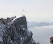
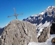
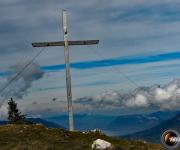
Bauges_ Croix (la) du Roy.
Den: 1121 m (M)_ Doussard, Montgellaz _ iGN 3432 OT. (05/2009) -
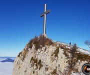
Bauges_ Croix d'Allant.
Den: 500 m (F)_ Ecole, Jarsy, le Coudray _iGN 3432 OT. (03/2014) -
Bauges_ Croix des Bergers.
Den: 480 m (M)_ Chambéry, le Revard _ iGN 3332 OT. (04/2018) -
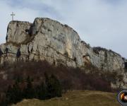
Bauges_ Croix du Clergeon.
Dén: 450 m (M)_ la Biolle, Cessens _ iGN 3332 OT. (03/2021). -
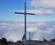
Bauges_ Croix du Nivolet par la Féclaz.
Den: 240 m (F)_ La Féclaz, la Sitre _iGN 3332 OT. (04/2013) -
Bauges_ Croix du Nivolet, grotte à Carret.
Den: 963 m (D)_ Hameau de Lovettaz _iGN 3332 OT. (11/2014) -
Bauges_ Croix du Nivolet par le Favre.
Den: 650 m (F)_ les Favres _iGN 3332 OT. (01_2020) -
Bauges_ Croix du Nivolet par Pragondran.
Den: 720 m (D)_ Verel, Pragondran _iGN 3332 OT. (06/2017) -
Bauges_ Croix du Plane.
Dén: 730 m (F)_ St Pierre d'Albigny, la Compôte _iGN 3432 OT. (12/2021) -
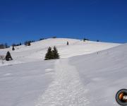
Bauges_ Culaz(la) en raquettes.
Den: 720 m (M)_ Arith, Montagny _iGN 3432 OT. (01/2019) -
Bauges_ Dent d'Arclusaz _ col d'Arclusaz.
Den: 1121 m (D)_ École _ iGN 3432 OT. (11/2005) -
Bauges_ Dent d'Arclusaz par Col du Frêne.
Den: 1121 m (D)_ Col du Frêne _iGN 3432 OT. (07/2018) -
Bauges_ Dent d'Arclusaz_ Combe aux Chevaux.
Den: 1121 m (TD)_ École _ iGN 3432 OT. (11/2005) -
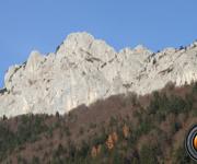
Bauges_ Dent de Cons.
Den: 1067 m (TD)_ Frontenex, parking du Planet _iGN 3432 ET. (10/2012) -
Bauges_ Dent de Rossanaz.
Dén: 987 m (F)_ Chambéry, Aillon le Vieux _iGN 3432 OT. (10/2006) -
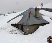
Bauges_ Fort de de Marthod.
Dén: 600 m (F)_ Marthod, lieu-dit le Villard _ iGN 3432 ET. (02/2017) -
Bauges_ Grand Roc (le).
Dén: 1600 m (M)_ Frontenex, Cléry, Le Raffort _iGN 3432 ET. (09/2014) -
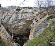
Bauges_ Grotte à Carret en boucle.
Den: 410 m (M)_ hameau de Lovettaz _iGN 3332 OT. (11/2014) -
Bauges_ Grottes de Bange.
Dén: 130 m (M)_ Cusy, pont de Bange, "Chez Martinot" _ iGN 3432 OT. (12/2012) -
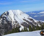
Bauges_ Margériaz (le).
Dén: 631 m (F)_ Aillon le Vieux, station du Margériaz _ iGN 3432 OT. (08/2013) -
Bauges_ Mont Colombier_Aillon le Jeune.
Dén: 860 m (F)_ Aillon le Jeune _ iGN 3432 OT. (04/2011) -
Bauges_ Mont Colombier_ Aillon-le-Vieux.
Dén: 1135 m (F)_ Aillon le Vieux _ iGN 3432 OT. (10/2006) -
Bauges_ Mont Julioz.
Dén: 600 m (D)_ Le Chatelard, les Garins _ iGN 3432 OT. (06/2017) -
Bauges_ Mont Morbié.
Dén: 811 m (F)_ Col du Frêne, Routhennes _ iGN 3432 OT. (12/2006) -
Bauges_ Mont Peney.
Den: 900 m (D)_ St Jean d'Arvey, Lovettaz _iGN 3332 OT. (05/2019) -
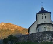
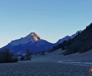
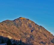
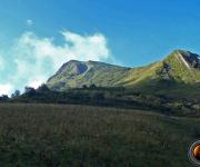
Bauges_ Mont Saint-Michel.
Dén: 80 m (TF)_ Challes les Eaux, Curienne _ iGN 3432 OT. (08/2018) -
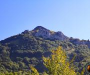
Bauges_ Mont Saint-Michel en boucle.
Dén: 430 m (M)_ Challes les Eaux, Curienne _ iGN 3432 OT. (12/2025) -
Bauges_ Mont Trélod par Dent de Pleuven.
Dén: 1250 m (M)_ Doucy Dessus, lieu-dit Magnoux _ iGN 3432 OT. (12/2016) -
Bauges_ Mont Trélod par "les Cornes".
Dén: 1111 m (F)_ Doucy, les Cornes _ iGN 3432 OT. (10/2004) -
Bauges_ Montagne de la Biolle.
Dén: 950 m (M)_ Aix les Bains, Brison Saint-Innocent _ iGN 3332 OT. (03/2019) -
Bauges_ Monts Pecloz & Armanaz_ Bellevaux.
Dén: 1522 m (M)_ Saint-Pierre d'Albigny, École _ iGN 3432 OT. (09/2005) -
Bauges_ Monts Pécloz & Armenaz par Varapet.
Den: 1450 m (D)_ Saint-Pierre d'Albigny, École _ iGN 3432 OT. (07/2018) -
Bauges_ Parc du Mouton.
Dén: 1300 m (M)_ Col de Tamié, Abbaye de Tamié _iGN 3432 ET. (04/2011) -
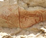
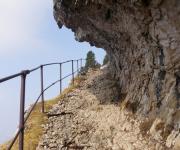
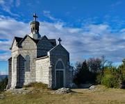
Bauges_ Peinture rupestre.
Dén: 943 m (F & TD)_ Saint-Jean d'Arvey, lieu dit le Puisat _iGN 3432 ET. (11/2014) -
Bauges_ Pic de la Sauge.
Dén: 1116 m (M)_ Saint-Alban Leysse, Curienne, Arvey _iGN 3432 OT. (12/2015) -
Bauges_ Pointe d'Arcalod.
Dén: 1210 m (D)_ École, Nant Fourchu _iGN 3432 OT. (06/2010) -
Bauges_ Pointe de Banc Plat.
Dén: 811 m (M)_ le Mont Derrière, parking du Reposoir _iGN 3432 OT. (06/2013) -
Bauges_ Pointe de Chaurionde, crête sud.
Den: 1100 m (M)_ Ecole, Nant Fourchu _iGN 3432 ET & OT. (06/2018) -
Bauges_ Pointe de Chaurionde par col d'Orgeval.
Dén: 1070 m (M)_ École, Nant Fourchu _iGN 3432 ET & OT. (06/2010) -
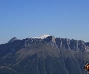
Bauges_ Pointe de Chaurionde par Seythenex.
Dén: 1047 m_ Ecole, Nant Fourchu _iGN 3432 ET & OT. (06/2010) -
Bauges_Pointe de Chaurionde par Tamié.
Dén: 1120 m (F)_ Chambéry, Abbaye de Tamiè _iGN 3432 ET & OT. (12/2016) -
Bauges_Pointe de la Belle Etoile par les Combes.
Dén: 1022 m (D)_ Frontenex, Lieu dit les Combes _iGN 3432 ET. (05/2012) -
Bauges_ Pointe de la Belle Etoile par Tamié.
Dén: 760 m (M)_ Col de Tamié _iGN 3432 ET. (12/2016) -

Bauges_ Pointe de la Fougère.
Dén: 1065 m(M)_ Ecole, Nant Fourchu _iGN 3432 ET. (10/2015) -
Bauges_ Pointe de la Galoppaz_ Arvey.
Dén: 950 m (M)_ Curienne, Arvey _iGN 3432 ET. (09/2012) -
Bauges_ Pointe de la Galoppaz_ col de Marocaz.
Dén: 750 m (F)_ Montmélian, col du Marocaz _iGN 3432 ET. (09/2019) -
Bauges_ Pointe de la Sambuy.
Dén: 1455 m (D)_ Neuvillard, les Losserands, les Tissots, Rapanet _iGN 3432 ET. (08/2014) -
Bauges_ Pointe de Vélan.
Dén: 1036 m (M)_ Seythenex, le Villaret, vallon de Saint-Rulph _iGN 3432 OT. (05/2013) -
Bauges_ Pointe des Arces.
Dén: 1197 m_ Col du Festre, École, parking de Bellevaux _ iGN 3432 OT. (08/2013) -
Bauges_ Pointe des Arlicots.
Dén: 1200 m (D)_ École, torrent du Chéran, parking de Bellevaux _ iGN 3432 OT. (08/2017) -
Bauges_ Refuge de la Combe.
Dén: 900 m_ le Mont Derrière, parking du Reposoir _iGN 3432 OT. (03/2013) -
Bauges_ Roc de Tormery en raquettes.
Dén: 540 m (M)_ Montmélian, la Thuile _ iGN 3432 OT. (01/2018) -
Bauges_ Roc des Boeufs.
Dén: 727 m_ Lescheraine, Bellecombe en Bauges, le Mont _ iGN 3432 OT. (11/2012) -
Bauges_ Roc Rouge ou La Négresse.
Dén: 960 m (D)_ Gilly sur Isére, la Frasse _iGN 3432 ET. (06/2019) -
Bauges_ Roche du Guet.
Dén: 357 m (F)_ Montmélian, la Thuile _ iGN 3432 OT. (12/2017) -
Bauges_ Rocher de Manettaz.
Dén: 810 m (F)_ Montmélian _ iGN 3432 OT. (04/2022) -
Bauges_ Rochers de la Bade.
Dén: 1179 m_ Chambéry, Aillon le Jeune _ iGN 3432 OT. (08/2013) -
Bauges_ Tapin (le) par Chignin.
Dén: 1050 m (D)_ Chignin _ iGN 3432 OT. (10/2014) -
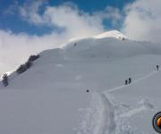
Bauges_ Tour de 3 jours dans les Bauges.
Dén: 4420 m_ Seythenex, station de la Sambuy_ iGN 3432 OT. (05/2009)